|
More Features, More Satellite Power Behind our Toughest, Brightest Touchscreen
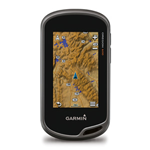
- 3" sunlight-readable touchscreen display with dual orientation
- 3-axis compass with accelerometer and barometric altimeter sensors
- Worldwide basemap with shaded relief
- Dual battery system — 2 AA batteries or optional rechargeable internal NiMH pack
With high-sensitivity GPS and GLONASS satellite tracking, worldwide basemap with shaded relief and customizable buttons for 1-touch waypoint marking, Oregon 600 opens a new world of GPS mapping and positioning.
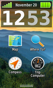
Touch and Go
Oregon 600 has reflective display technology for the most brilliant, sunlight readable touchscreen we’ve ever made. The screen is strengthened for impact resistance, with multi-touch and dual orientation views that accommodate gloved operation.
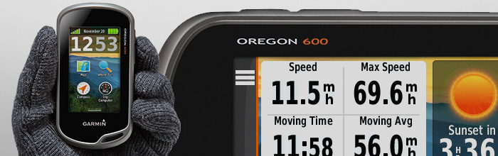
Double Your Power
Oregon 600 features our state-of-the-art dual battery system. Use the optional rechargeable NiMH pack (not included) or traditional AA batteries — NiMH pack charges when the device is connected to external power.
 |
|
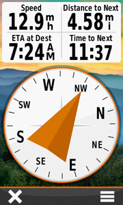
Get Your Bearings
Oregon 600 has a built-in 3-axis electronic compass with accelerometer tilt compensation to show where you're heading even when standing still, or not holding it level. Its barometric altimeter tracks changes in pressure to pinpoint your precise altitude. You can even use it to plot barometric pressure over time to keep an eye on changing weather conditions.
With its high-sensitivity, WAAS- and GLONASS-enabled GPS receiver and HotFix® satellite prediction, Oregon 600 locates your position quickly and precisely, and maintains its GPS location even in heavy cover and deep canyons.
|
Share Wirelessly
With Oregon 600 you can share your waypoints, tracks, routes and geocaches up to 50 times faster with other wireless compatible Garmin handheld devices. Plus, you can share large files too like photos, Garmin Adventures and Custom Maps. Just touch “send” to transfer your information.
Add Maps
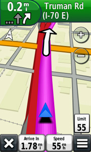
Adding more maps to Oregon is easy. Load TOPO U.S. 24K maps and hit the trail; add Trailhead Series TOPO maps and explore famous treks like the Appalachian Trail and the Pacific Crest Trail; plug in BlueChart® g2 preloaded cards for a great day on the water; or load City Navigator® map data for turn-by-turn routing on roads. Add satellite images to your maps with BirdsEye Satellite Imagery (subscription required). You can even display and enter grid references in Irish Grid (IG) or in the new Irish Transverse Mercator (ITM) grid.
Load All the Geocaches
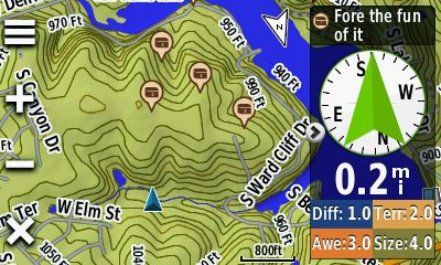
No more picking, choosing and planning, just download them all. Oregon 600 can hold up to 4 million. Download every cache on OpenCaching.com. Load caches from GSAK. Or use your favorite program or website supporting GGZ files. All your paperless geocaching features will be there for every cache. Read full descriptions, hints and logs. View cache photos. Filter caches by size, terrain, difficulty and type. Connect to chirp-enabled caches. Record your logs in the field. Do it all.
Plan Your Next Trip
Take charge of your next adventure with BaseCamp™, software that lets you view and organize maps, waypoints, routes and tracks. This free trip-planning software even allows you to create Garmin Adventures that you can share with friends, family or fellow explorers. BaseCamp displays topographic map data in 2-D or 3-D on your computer screen, including contour lines and elevation profiles. It also can transfer an unlimited amount of satellite images to your device when paired with a BirdsEye Satellite Imagery subscription.
 |
Display Brightness
Reflective display technology uses external light, such as sunlight, in combination with the device’s LED backlight to increase brightness and viewing. Plus, you conserve power by not having to turn the backlight up. |
|
|
|
Dual Orientation
View maps and data in portrait or landscape mode. Landscape mode is great for typing and road navigation. |
|
|
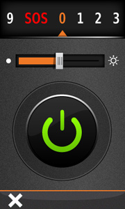 |
Flashlight
Torch has high and low brightness levels and strobe options to conserve battery power. |
|
|
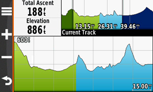 |
Advanced Elevation Plot
Full Track view lets you see the entire elevation plot and quickly move your zoomed view to any place on the plot. Future Plot uses your mapping data to show what to expect ahead. |
|
|
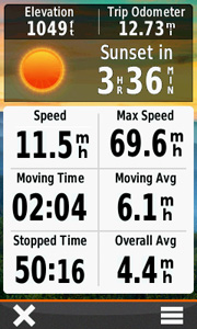 |
Improved Trip Computer
Get 33 percent more data on screen at once with new layout options. Add multiple pages of data fields, each customizable to 1 of 4 layouts: 2 large, 1 large and 4 small, 6 small or 8 small. |
|
|
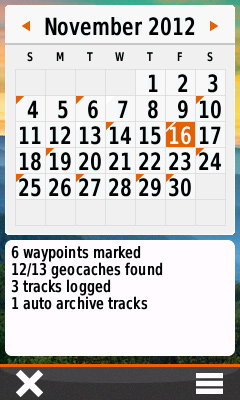 |
Activity Tracking (Calendar)
Track your accumulated activities, waypoints and geocaches; tracks on the day you do them. |
|
|
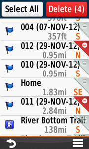 |
Advanced Waypoint Management
All data is displayed and editable on 1 screen. Delete 1 or multiple waypoints at a time from the Waypoint Manager menu. |
|
|
 |
Wireless Capable: Bluetooth® and ANT
Now you can wirelessly transfer large files such as photos, geocaches, adventures, routes and Custom Maps between Oregon 600-series devices (or with Garmin Basecamp Mobile). Plus, new technology allows your routes, waypoints and tracks to transfer up to 50 times faster. Oregon is also ANT+ wireless compatible for heart rate, cadence, chirp™ and tempe™ sensors. |
|
|
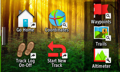 |
Shortcuts
Launch apps, switch Profiles, apply settings and start navigating with 1 touch. |
|
|
 |
Dashboards/nüvi® Mode
Dashboards let you hide and show more functions to your favorite app. With this at-a-glance information, you can multi-task without having to disable the app. |
|
| Physical Performance |
| Unit dimensions, WxHxD: |
2.4" x 4.5" x 1.3" (6.1 x 11.4 x 3.3 cm) |
| Display size, WxH: |
1.5"W x 2.5"H (3.8 x 6.3 cm); 3" diag (7.6 cm) |
| Display resolution, WxH: |
240 x 400 pixels |
| Display type: |
transflective color TFT touchscreen |
| Weight: |
7.4 oz (209.8 g) with batteries |
| Battery: |
2 AA batteries (not included); NiMH or Lithium recommended, rechargeable NiMH pack (optional) |
| Battery life: |
16 hours |
| Waterproof: |
yes (IPX7) |
| Floats: |
no |
| High-sensitivity receiver: |
yes |
| Interface: |
high-speed USB and NMEA 0183 compatible |
|
| Maps & Memory: |
| Basemap: |
yes |
| Preloaded maps: |
no |
| Ability to add maps: |
yes |
| Built-in memory: |
1.5 GB |
| Accepts data cards: |
microSD™ card (not included) |
| Waypoints/favorites/locations: |
4000 |
| Routes: |
200 |
| Track log: |
10,000 points, 200 saved tracks |
| Features & Benefits: |
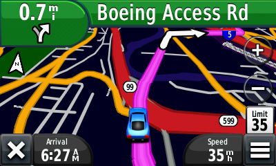
| Automatic routing (turn by turn routing on roads): |
Yes (with optional mapping for detailed roads) |
| Electronic compass: |
Yes (tilt-compensated 3-axis) |
| Touchscreen: |
Yes |
| Barometric altimeter: |
Yes |
| Camera: |
no |
| Geocaching-friendly: |
yes (paperless) |
| Custom maps compatible: |
yes |
| Photo navigation (navigate to geotagged photos): |
yes |
| Outdoor GPS games: |
no |
| Hunt/fish calendar: |
yes |
| Sun and moon information: |
yes |
| Tide tables: |
product Template.tab.specs.picklist.yes with optional bluechar |
| Area calculation: |
yes |
| Custom POIs (ability to add additional points of interest): |
yes |
| Unit-to-unit transfer (shares data wirelessly with similar units): |
Yes (plus images and custom maps) |
| Picture viewer: |
Yes |
| Garmin Connect™ compatible (online community where you analyze, categorize and share data): |
yes |
What's in the Box:
- Oregon 600
- Worldwide basemap
- USB/charging cable
- Carabiner clip
- Documentation
View all | Collapse all
Accessories Kits
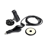 Auto Nav Kit
010-10851-10
AA Guides
 Download: AA Hotel Guide
010-D0125-05
 AA Pub Guide
010-D0125-06
 Download: AA Restaurant Guide
010-D0125-07
 Download: AA Guides
010-D0125-50
 Download: AA Days Out Guide
010-D0125-01
 Download: AA B&B Guide
010-D0125-02
 Download: AA Camping & Caravanning Guide
010-D0125-03
 Download: AA Golf Guide
010-D0125-04
 Download: AA London Guide
010-D0125-09
 Download: AA New York Guide
010-D0125-10
 Download: AA Rome Guide
010-D0125-11
 Download: AA Amsterdam Guide
010-D0125-19
 Download: AA Italy Guide
010-D0125-15
 Download: AA Florence & Tuscany Guide
010-D0125-16
 Download: AA Dublin Guide
010-D0125-17
 Download: AA Venice City Guide
010-D0125-18
Mounts
 Auto Friction Mount
010-11602-00
 Marine/Cart Mount
010-11031-00
 Bike/Cart Mount
010-11023-00
Cables
 Vehicle Power Cable
010-10851-11
 USB Cable
010-10723-01
Cases and Covers
 Carrying Case
010-11734-00
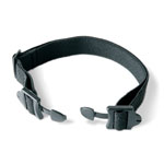
Lanyards, Straps, Holsters and Clips
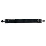
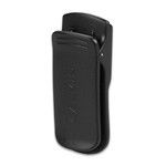
 Belt Clip
010-11734-20
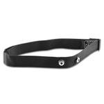
 Carabiner Clip
010-11022-20
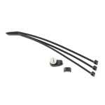
 OpenCaching Lanyard
M00-60247-00
 Belt Clip
010-11022-10
Geocaching
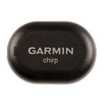 chirp
chirp
010-11092-20
 Official Geocaching Kit
010-11663-00
Sensors
 tempe™ Wireless Temperature Sensor
010-11092-30
Fitness Sensors
 Speed/Cadence Bike Sensor
010-10644-00
 Heart Rate Monitor
010-10997-00
Fitness Parts
 Elastic strap for Heart Rate Monitor
010-10714-00
 Heart rate monitor elastic strap, Small
010-10714-01
 Speed/Cadence sensor (GSC 10) replacement parts
010-10714-01
Caps
 Khaki OpenCaching Cap
M06-40011-00
Clothing
 OpenCaching T-shirt
M06-00210-00
 OpenCaching T-shirt
M06-00210-01
AA Guides
 Download: AA Barcelona Guide
010-D0125-12
 Download: AA Prague Guide
010-D0125-13
 Download: AA South Africa Guide
010-D0125-14
 Download: AA Paris Guide
010-D0125-08
 Download: AA France Guide
010-D0815-00
 Download: AA Spain Guide
010-D0816-00
Batteries
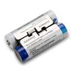 NiMH Battery Pack
010-11874-00
Lanyards, Straps, Holsters and Clips
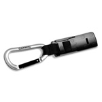 Carabiner clip
010-11022-20
 Belt clip
010-11734-20
Fitness Parts
 Replacement soft strap
010-11254-20
|
|
|